$2,200,000
33941 ValenciaDana Point, CA 92629Dana Light II
Sold
33821 Malaga Drive sold on February 14, 2024 for $605,000. The details are below for reference.
Own 33821 Malaga Drive? Request a free home valuation to see what it is worth today.
The home
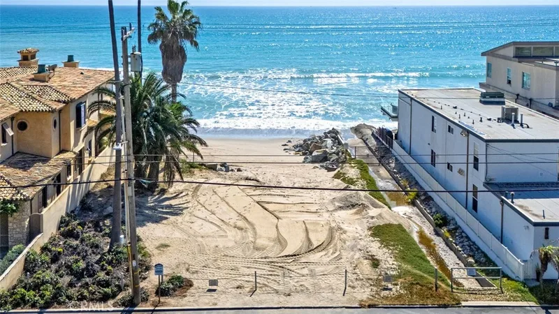
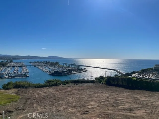
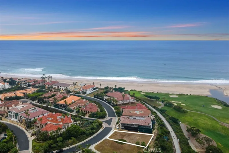
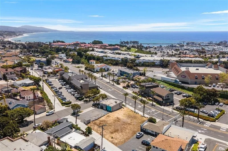
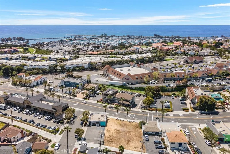
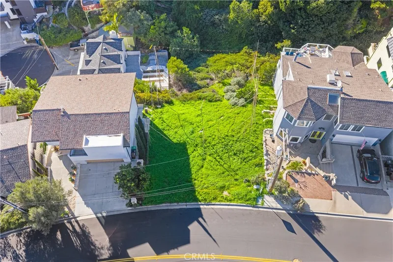
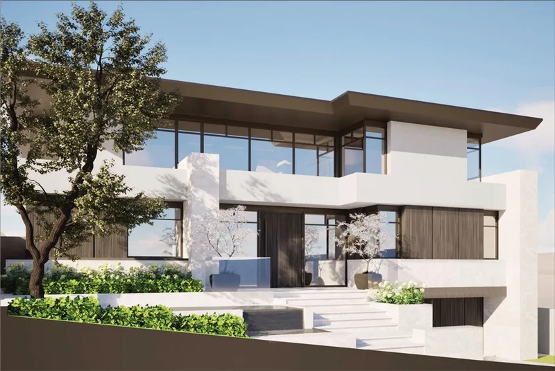
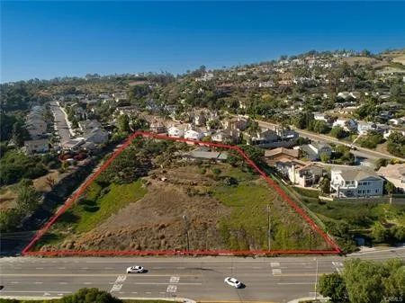
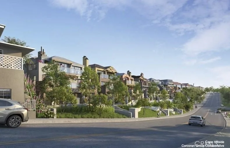
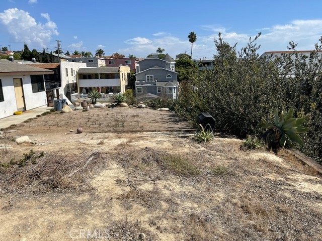
One of the few remaining Ocean View lots in the Lantern District. Great opportunity to build your 3-story dream home with roof deck on a fabulous street. Panoramic ocean views from all levels. NO HOA and NO Mello Roos Tax. Close proximity to Dana Point Harbor, Restaurants, Shopping, Beaches, Schools and Parks.
This home sits in the Lantern Village Central neighborhood of Dana Point in Orange County. The MLS record lists the assessor parcel number as 682-263-22. Highlights include ocean and panoramic views.
Specifications
The record
| Date | Event | Price | Note |
|---|---|---|---|
| Feb 14, 2024 | Sold | $605,000 | |
| Feb 11, 2024 | Status changed to Pending | From Active Under Contract | |
| Jan 18, 2024 | Status changed to Active Under Contract | From Active | |
| Oct 17, 2023 | Price reduced | $650,000 | From $700,000 |
| Jul 22, 2023 | Relisted | $700,000 | |
| Jul 9, 2021 | Sold | $700,000 | Advantage Investment Propertie |
Added by Realatrends Real Estate
We looked up this home's map point in public government maps. These facts are not part of the MLS listing.
Zone X, area of minimal flood hazard. Outside FEMA's Special Flood Hazard Area.
FEMA National Flood Hazard Layer, FIRM panel 06059C0502K effective March 21, 2019. Checked October 15, 2026.
Not in a fire hazard severity zone on the State Fire Marshal's map.
CAL FIRE, State Fire Marshal map for Local Responsibility Areas, March 24, 2025. Checked October 15, 2026.
Outside the Alquist-Priolo Earthquake Fault Zones.
California Geological Survey, Earthquake Fault Zones. Checked October 15, 2026.
Outside the liquefaction zones.
California Geological Survey, Seismic Hazard Zones map, Dana Point quadrangle, released December 21, 2001. Checked October 15, 2026.
Outside the earthquake-induced landslide zones.
California Geological Survey, Seismic Hazard Zones map, Dana Point quadrangle, released December 21, 2001. Checked October 15, 2026.
Outside the Tsunami Hazard Area on the State's evacuation planning map.
California Geological Survey and Cal OES, Tsunami Hazard Area map for Orange County (2021). Checked October 15, 2026.
Fiber: Cityside Fiber, up to 5,000 Mbps, at 29 of 29 residential locations in this census block. Cable: Cox Communications, up to 2,000 Mbps, at 29 of 29.
FCC National Broadband Map, provider-reported data as of December 31, 2025, for census block 060590423135002, not for this address. Not endorsed by the FCC. Checked October 15, 2026.
Nearest public charger 0.5 miles away (ChargePoint, 2 Level 2 ports). 77 public charging ports within 3 miles.
U.S. Department of Energy, Alternative Fuels Data Center. Straight-line distance. Checked October 15, 2026.
These facts are for the listing's map point, which can sit off the lot. A zone line can also cross a lot, and agencies revise their maps. In cities, the fire zone line follows the State Fire Marshal's 2025 map; each city adopts its own map and may add areas. These lines are not a Natural Hazard Disclosure. Check the official maps and the seller's disclosures before you rely on them. Sources for the earthquake zone lines: Reproduced with permission, California Geological Survey, Webservice of Official Maps of Alquist-Priolo Earthquake Fault Zones (2025). Reproduced with permission, California Geological Survey, Webservice of Official Maps of Seismic Hazard Zones (2025).
Official maps
Next steps
33821 Malaga Drive is no longer on the market, but comparable homes come up in Dana Point regularly. We can tell you what this one actually closed at and set up alerts for listings that match it.
Thinking of selling nearby? We bring current Lantern Village Central sales data and a clear pricing strategy to every listing, backed by more than 700 closed sales and over $1B in Orange County volume. Start with a free home valuation, or reach out to talk through your options.
The neighborhood
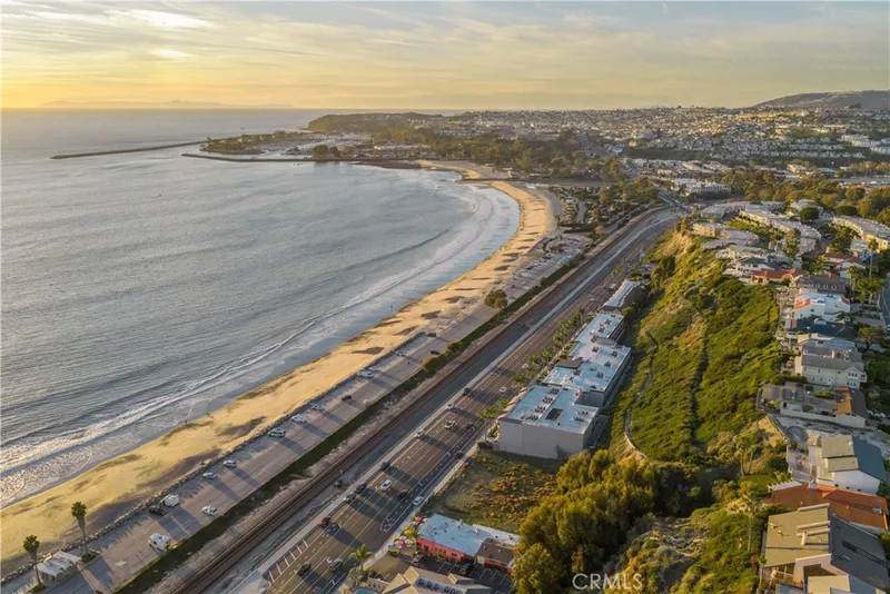
Dana Point sits on the Pacific coast in south Orange County, between Laguna Beach and San Clemente, anchored by Dana Point Harbor and bluff-top headlands above Doheny State Beach, Salt Creek Beach, and Strands Beach. Its Lantern District carries street names like Blue Lantern and Violet Lantern, within the Capistrano Unified School District.
See 4 homes for sale in Lantern Village Central Dana Point housing market
Nearby listings
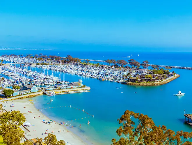 Dana PointSee every home for sale in Dana Point
Nearby sales
Dana PointSee every recent sale in Dana PointJust listed
Explore
See every home for sale in Dana Point, or search the full Orange County MLS on our live homes search. Questions about 33821 Malaga Drive? Talk to Realatrends.
New Dana Point homes by email, often before they reach the big portals.
You are all set.
Listed by Britt Cottrill of Coldwell Banker Realty
Listing information updated Feb 14, 2024 at 2:19 PM PT. Source: CRMLS.
 This information is for your personal, non-commercial use and may not be used for any purpose other than to identify prospective properties you may be interested in purchasing. The display of MLS data is usually deemed reliable but is NOT guaranteed accurate by the MLS. Buyers are responsible for verifying the accuracy of all information and should investigate the data themselves or retain appropriate professionals. Information from sources other than the Listing Agent may have been included in the MLS data. Unless otherwise specified in writing, the Broker/Agent has not and will not verify any information obtained from other sources. The Broker/Agent providing the information contained herein may or may not have been the Listing and/or Selling Agent.
Send a quick note and Clark will get back to you personally, or call 949·494·8830.
Send a note about this home and Clark will get back to you.
Pick a day and time that work. Clark confirms the details with you.