$615,000
3 bd · 2 ba · 1,128 sq ft16525 CaballeroHuntington Beach, CA 92649Huntington Townhomes
Sold
8221 Michael Drive sold on April 21, 2015 for $620,000, 0.8% above the $615,000 asking price after 39 days on the market; it was first listed at $625,000. The buyer financed the purchase. The details are below for reference.
Own 8221 Michael Drive? Request a free home valuation to see what it is worth today.
The home
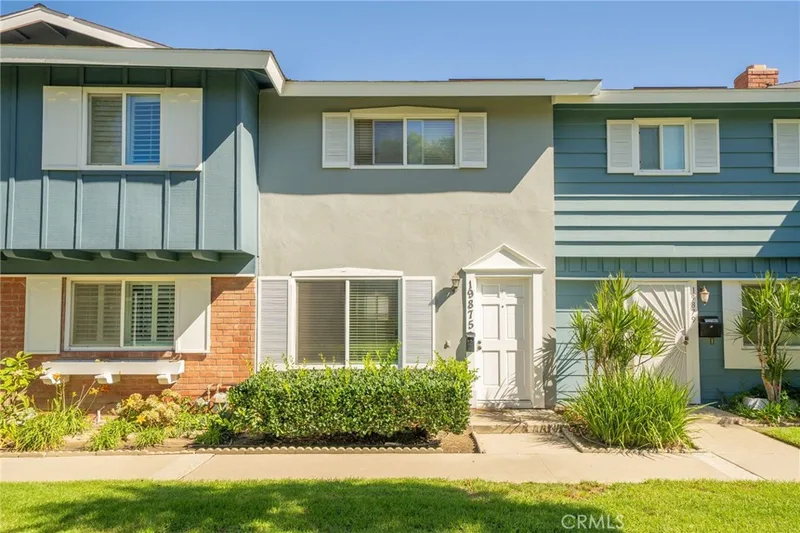
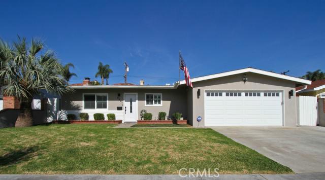
REMODELED WITH UPGRADES! This 3 bed, 2 bath single family residence features LED lights, crown molding, framed doors/windows, and wood laminate floors throughout! Upgraded front door features programmable entry. Kitchen has upgraded cabinets, granite counters, and ceramic tile floors. Open living room w/ ceiling fan and features recessed LED lighting, plantation shutters and marble fireplace. Master bedroom features large window, walk in closet and master bath upgraded with granite shower walls and new vanity. Second bedroom also features large closet and window. Second bath remodeled w/ solid metal tub, new wall to ceiling tiling, granite top vanity w/storage, and ceramic floors. Third bedroom has good size closet, chair railing, ceiling fan and double glass doors leading to back yard w/ covered patio and planter wall. Yard has been well maintained and LED floodlights have been installed on every side of the house. Garage has been upgraded with professional epoxy flooring, insulated walls and garage door, built in cabinets/counters, ceiling fan and wired to be used as additional living area. Exterior paint redone, and doors were all replaced in last 2 years. Front features large palm trees w/ great curb appeal. Shows pride of ownership.
This 3-bedroom, 2-bath single-family home sits in Huntington Beach in Orange County. It has 1,315 square feet of living space on a 6,098-square-foot lot. The home was built in 1962. The MLS record lists the assessor parcel number as 167-481-12. Highlights include a fireplace, single-story living, an attached two-car garage, and an updated home.
Specifications
The record
| Date | Event | Price | Note |
|---|---|---|---|
| Apr 21, 2015 | Sold | $620,000 | |
| Feb 2, 2015 | Listed for sale | $625,000 |
Added by Realatrends Real Estate
We looked up this home's map point in public government maps. These facts are not part of the MLS listing.
Zone X. Outside FEMA's Special Flood Hazard Area.
FEMA National Flood Hazard Layer, FIRM panel 06059C0253J effective December 3, 2009. Checked November 16, 2026.
Not in a fire hazard severity zone on the State Fire Marshal's map.
CAL FIRE, State Fire Marshal map for Local Responsibility Areas, March 24, 2025. Checked November 15, 2026.
Outside the Alquist-Priolo Earthquake Fault Zones.
California Geological Survey, Earthquake Fault Zones map, Newport Beach quadrangle, released July 1, 1986. Checked November 15, 2026.
Inside a Seismic Hazard Zone for liquefaction.
California Geological Survey, Seismic Hazard Zones map, Newport Beach quadrangle, released April 15, 1998. Checked November 15, 2026.
Outside the earthquake-induced landslide zones.
California Geological Survey, Seismic Hazard Zones map, Newport Beach quadrangle, released April 15, 1998. Checked November 15, 2026.
Outside the Tsunami Hazard Area on the State's evacuation planning map.
California Geological Survey and Cal OES, Tsunami Hazard Area map for Orange County (2021). Checked November 15, 2026.
Fiber: Frontier, up to 7,000 Mbps, at 20 of 29 residential locations in this census block. Cable: Spectrum, up to 1,000 Mbps, at 29 of 29. Fixed wireless: Cosmo Network Solutions, LLC, up to 350 Mbps, at 29 of 29.
FCC National Broadband Map, provider-reported data as of June 30, 2026, for census block 060590992123000, not for this address. Not endorsed by the FCC. Checked October 15, 2026.
Nearest public charger 0.6 miles away (ChargePoint, 2 Level 2 ports). 175 public charging ports within 3 miles.
U.S. Department of Energy, Alternative Fuels Data Center. Straight-line distance. Checked November 15, 2026.
These facts are for the listing's map point, which can sit off the lot. A zone line can also cross a lot, and agencies revise their maps. In cities, the fire zone line follows the State Fire Marshal's 2025 map; each city adopts its own map and may add areas. These lines are not a Natural Hazard Disclosure. Check the official maps and the seller's disclosures before you rely on them. Sources for the earthquake zone lines: Reproduced with permission, California Geological Survey, Webservice of Official Maps of Alquist-Priolo Earthquake Fault Zones (2025). Reproduced with permission, California Geological Survey, Webservice of Official Maps of Seismic Hazard Zones (2025).
Official maps
Next steps
8221 Michael Drive is no longer on the market, but comparable homes come up in Huntington Beach regularly. We can tell you what this one actually closed at and set up alerts for listings that match it.
Thinking of selling nearby? We bring current Huntington Beach sales data and a clear pricing strategy to every listing, backed by more than 700 closed sales and over $1B in Orange County volume. Start with a free home valuation, or reach out to talk through your options.
The neighborhood
Huntington Beach stretches along the Pacific coast in Orange County, anchored by its landmark pier, the Bolsa Chica Ecological Reserve, and Huntington Central Park, the largest city-owned park in the county. Nicknamed Surf City USA, the community spans beachfront blocks, the waterways of Huntington Harbour, and inland neighborhoods within the Huntington Beach Union High School District.
Recorded MLS closings of single-family homes, Nov 10, 2025 to Nov 10, 2026. Days on market run from listing to going under contract.
| Address | Closed | Price | Sq ft | Per sq ft | Days on market |
|---|---|---|---|---|---|
| 16842 Lucia | Nov 10, 2026 | $1,399,000 | 1,733 | $807 | 148 |
| 16781 Scotsdale Circle | Nov 10, 2026 | $1,000,000 | 1,948 | $513 | 0 |
| 19271 Harding Lane | Nov 10, 2026 | $1,258,000 | 1,473 | $854 | 10 |
| 5291 Kenilworth | Nov 9, 2026 | $1,920,000 | 3,192 | $602 | 29 |
| 20932 Coastview Lane | Nov 6, 2026 | $1,075,000 | 1,685 | $638 | 73 |
Nearby listings
Nearby sales
| Home | Sold price | Asking | Of asking | Beds | Baths | Sq ft | Per sq ft | Days on market |
|---|---|---|---|---|---|---|---|---|
 17572 Van BurenSold Nov 13, 2026 | $839,000 | $849,000 | 99% | 3 | 3 | 1,269 | $661 | 90 |
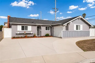 17472 Waal CircleSold Sep 10, 2026 | $1,110,000 | $1,099,000 | 101% | 4 | 2 | 1,279 | $868 | 15 |
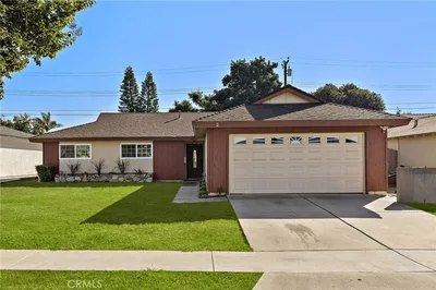 8292 DarsySold Dec 26, 2025 | $1,130,000 | $1,199,000 | 94% | 4 | 3 | 1,457 | $776 | 9 |
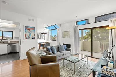 17641 Sergio Circle 203Sold Feb 17, 2026 | $610,000 | $620,000 | 98% | 2 | 2 | 1,007 | $606 | 179 |
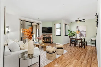 17722 Sergio Circle CI104Sold Jan 23, 2026 | $625,000 | $649,900 | 96% | 2 | 2 | 957 | $653 | 115 |
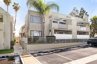 17722 SergioSold Mar 16, 2026 | $630,000 | $620,000 | 102% | 2 | 2 | 1,007 | $626 | 8 |
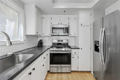 17702 Sergio Circle 102Sold Oct 13, 2026 | $590,000 | $618,000 | 95% | 2 | 2 | 1,007 | $586 | 25 |
Medians of these 7 sales: $630,000 sold, 98% of asking, $653 per sq ft, 25 days on market. Asking is the last list price before the sale.
See every recent sale in Huntington BeachJust listed
Explore
See every home for sale in Huntington Beach, or search the full Orange County MLS on our live homes search. Questions about 8221 Michael Drive? Talk to Realatrends.
New Huntington Beach homes by email, often before they reach the big portals.
You are all set.
Listed by Elizabeth Do of Keller Williams Realty
Listing information updated Apr 30, 2021 at 9:41 AM PT. Source: CRMLS.
 This information is for your personal, non-commercial use and may not be used for any purpose other than to identify prospective properties you may be interested in purchasing. The display of MLS data is usually deemed reliable but is NOT guaranteed accurate by the MLS. Buyers are responsible for verifying the accuracy of all information and should investigate the data themselves or retain appropriate professionals. Information from sources other than the Listing Agent may have been included in the MLS data. Unless otherwise specified in writing, the Broker/Agent has not and will not verify any information obtained from other sources. The Broker/Agent providing the information contained herein may or may not have been the Listing and/or Selling Agent.
Send a quick note and Clark will get back to you personally, or call 949·494·8830.
Send a note about this home and Clark will get back to you.
Pick a day and time that work. Clark confirms the details with you.